Hiking in Mount Takao
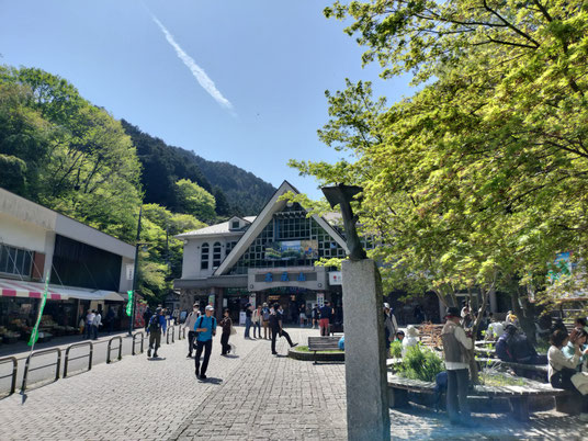

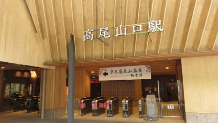
Located approximately 50 kilometers west of Tokyo, Mount Takao holds the title as the "most climbed mountain in the world" with over 2. 6 million visitors annually. Direct access from Shinjuku is possible with the use of the Keio Train.
However it is not just the convenient location that makes Mt. Takao a special place.
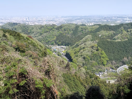
Despite being only 599 meters in altitude (This is lower than the height of the Tokyo Skytree!), there are over 1,600 species of plants in this mountain alone- about the same amount that can be found in Great Britain.
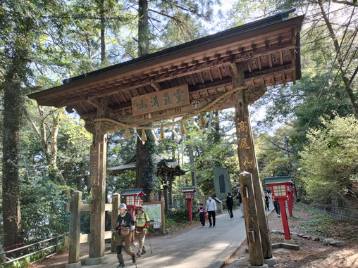
Like many other mountains in Japan, Mt Takao has also had spiritual importance, there are traces of religious training being held here since the 8th century.
So a visit to Mount Takao is not just a good way to get away from the madness of Japan's capital city, it is a great chance to appreciate history and gain understanding to how religion has held a place in the Japanese mind.
How to book this tour:
🕓Start Time: Between 9am and 11:30am. Duration of tour is about 4-5 hours including transit time from central Tokyo.
👪Number of people: Max of 4 people can participate
💱Tour Fee: 32,000 JPY
🏴Meeting Location: At your hotel in central Tokyo.
📅Cancellation Policy: Since the weather can impact this tour, I will allow free cancellation up to 24 hours before the scheduled meeting time.
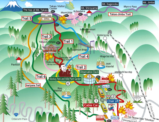
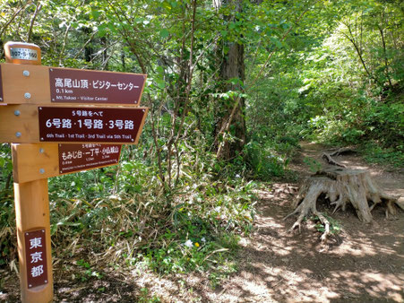
Introduction to the different trails:
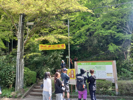
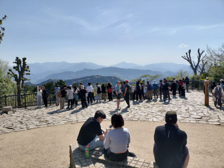
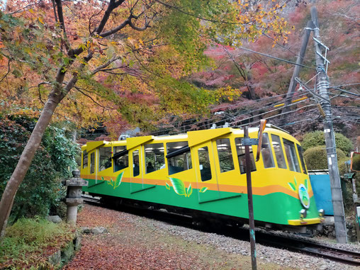
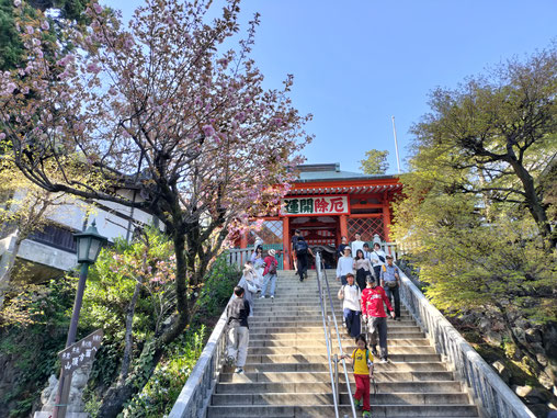
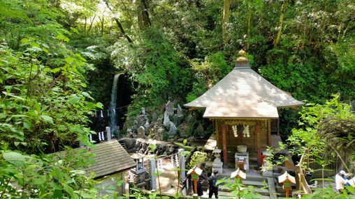
Trail 1 - Completely paved and with many attractions along the way.
Required time: 1hr20-40 min from the bottom or 1 hour if using cable car
Difficulty: The toughest part of the climb can be avoided by taking the cable car or chairlift. Once past the upper cable car station, it is mostly flat except for some steep stairs at the Yakuo-in temple.
What to wear: Many young people do it in street clothes, just make sure you wear shoes that you find comfortable
Congestion: There can be long waiting times for the cable car/chairlift, sometimes even exceeding an hour on busy weekends in spring/autumn. Going down is where the lines get particularly long.
There is a lot to see along this main trail, so I would suggest this route for at least one leg. This is the only route where there are restrooms or shops along the way.
Because the entire section is paved, at times it might feel like being in a city park rather than the mountains.
❕ For the cable car/lift, a SUICA or PASMO card cannot be used directly at the gate. However you can use these cards to make a purchase at the ticket machine.
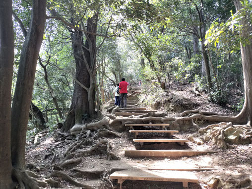
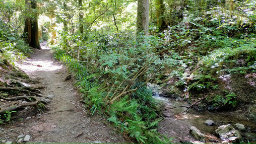
Trail 4 - along a creek and a small waterfall
Required time: 1hr 20-40 min
Difficulty: Steep climb towards the end. Trail tends to be wet
What to wear: Clothing appropriate for hiking is necessary. Trekking shoes a must due to the muddy surface.
Congestion: Popular among the more experienced hikers. Since the path is narrow, becomes one-way (climbing only) in peak season like autumn.
Interesting route for those seeking a more genuine hiking experience. However better to avoid if there has been bad weather.

Inariyama Trail - the southernmost route through a mostly evergreen forest
Required time: 1hr10-30 min
Difficulty: Steep climb at the start and long stairs at the end.
What to wear: In dry weather, a good walking shoe will do as this route is well maintained with many wooden steps installed in sections with any incline.
Congestion: Can get busy on weekends, but most sections are wide enough to not cause too much stress.
There are several benches to rest along the way. It is mostly evergreen along the route so the scenery can look a bit dull even in the spring or autumn. However the trail is about the right level for visitors who want a casual hiking experience. If you want to reach the summit without use of the cable car, this might be a better choice compared with Trail 1 which requires you to climb a steep paved road for the first half of the walk.